LauderTrail: Connecting FTL
A Trail System for Everyone
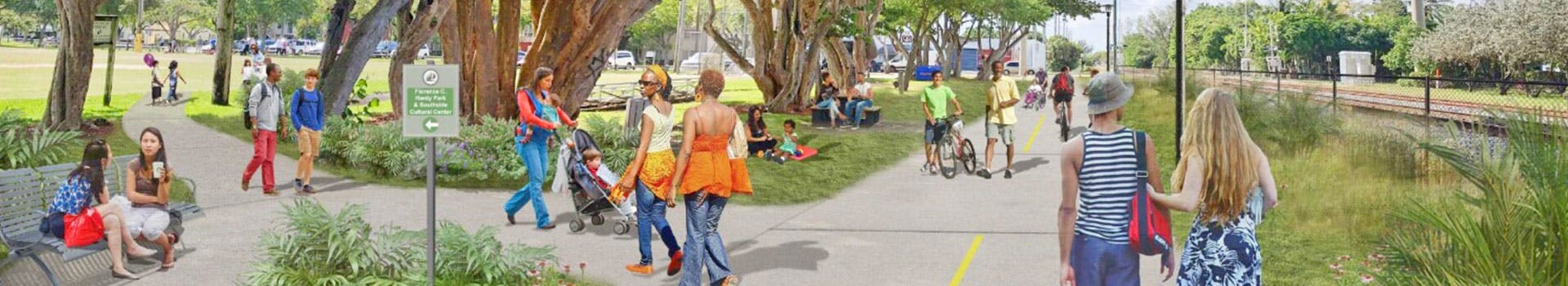
The City of Fort Lauderdale is developing a high-quality trail system designed for pedestrians and bicyclists who want low-stress routes and safe separation from traffic, serving as an alternate transportation system and a recreational option for residents and visitors alike.
When complete, LauderTrail will use 8 miles of existing trails, incorporate 3 miles of programmed trails, and add 31 miles of new trails. The labyrinth of trails criss-crossing the city will connect 270 businesses, 45 parks and green spaces, 35 neighborhoods, 17 bus routes, 12 schools, 12 Water Taxi stops, and two railway stations.
LauderTrail continues to be a true community effort, planned and led by a team of residents from every corner of the City. The overall plan of the proposed trail system is divided into five segments -- Eastside Trail, Central Loop, Southeast Trail, Southwest Trail, and Northside Trail. Segments 1 and 2 -- The Eastside Trail and Central Loop -- are moving into the design phase.
The Eastside Trail will run approximately 4.9 miles, weaving from NW Flager Avenue at NW 4th Street to N Dixie Highway at NE 17th Court. The trail will connect FAT Village, Holiday Park, Victoria Park, George English Park, and more.
The Central Loop covers 5.8 miles between westside neighborhoods, the existing Riverwalk, and the spine trail parallel to FEC tracks, connecting Mills Pond Park, Sailboat Bend, the Brightline station, Carter Park, and more.
Click to take a look at the Master Plan.
MAKE YOUR VOICE HEARD!
Share your feedback now. Take our survey!

Who's Listening
-
Mayor, City of Fort Lauderdale